
Build a Model of the Real World
Analyze Real-World Conditions
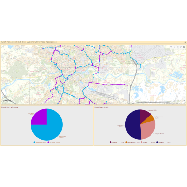
An essential component of environmental management is the ability to model and understand real-world conditions and their complex relationships in order to make better informed decisions.
Perform Complex Spatial Analysis
Geospatial technologies have the potential to discover and visualize hidden data, reveal patterns, and to perform complex spatial analysis associated with protecting and sustaining natural & cultural resources.
- Air Pollution Analysis
- Biodiversity Monitoring
- Flood Analysis
- Impervious Surfaces Mappings
- Land Use Management
- Military Land Management
- Stormwater and Wastewater Management
Learn More
Discover through the case studies, services and products below how GISonLine has supported clients within the Environmental Management sector.

Environmental Management
Case Studies


Our Services

GIS Implementation & Integration

Data Management & Visualization

Aerial Inspections & Underground Detection
Our Products


GRIDonLine is a comprehensive GIS Utilities Asset Management (AM) system designed to scale from small to large enterprise utility networks.


UTIL.Inspections is a cloud-based (SaaS) web mapping application designed specifically for viewing, integrating and collaborating on survey & inspection datasets.


The innovative UTIL.Investments platform is designed to address the needs of industries involved in the design and implementation of linear infrastructure projects.

Contact us
Looking for Location Intelligence?

