

Enterprise Data Management
From Legacy to Modern Enterprise Asset Management
GISonLine’s utilities data migration and geospatial data management experience spans across multiple sectors and international projects. We work directly with utility operators and managers to help transition them from legacy to modern and integrated GIS platforms.
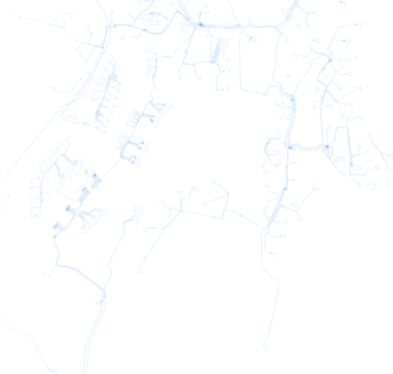
Esri ArcGIS Utility Network
Are you ready to transition to the ArcGIS Utility Network? ArcGIS Utility Network is the next generation spatial information system for managing utility networks. GISonline offers a full range of ArcGIS Utility Network consulting and implementation services with a focus on preparing utility operators and managers for a successful integration and migration of their utility network data and assets.
Migrate Your Data to ArcGIS Utility Network
GISonLine specializes in helping organization’s migrate their utilties data to the latest Esri ArcGIS Utility Network and provide key support and expertise for:
- Data migrations from GE Smallworld to Esri ArcGIS Utility Network
- Extract, Transform, Load (ETL) automation tools
- Establishing Utility Network business rules
- Resolving attribute and topology Utility Network errors
- Providing specialized data migration tools with QA/QC checking
- Integrating ArcGIS Utility Network with existing Business Systems (Ex: IBM Maximo, SAP)

Maintain Your Utilities & Asset Data
Get Location & Attribute Accuracy
No system is able to provide valuable decision support and analysis without accurate data. GISonline understands that keeping data up-to-date is no small undertaking and requires the resources, skills, and use of automated tools to support data maintenance processes.
Expert Support To Help Maintain Your Data
GISonLine offers comprehensive services designed to keep industry data such as Utility Assets up-to-date and to maintain the data directly within client GIS systems. Together with our clients, we ensure end-users are working with the most current and accurate datasets that support needed analysis and client requirements.
Take advantage of GISonLine’s Team as a Service offerings designed to provide clients with key personnel such as Data Managers, Geospaital technicians, and Busines Intelligence experts.
Data Maintenance Services Offerings:
- Working directly on the client’s source system to maintain the data
- Applying client’s desired standards and procedures
- Adopting industry standard Data Models
- Utilizing quality control tools and procedures to ensure quality & spatial accuracy
- Improving data to support adoption and integration with other systems
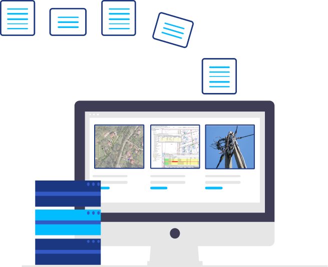

Migrate Data Into Desired Formats
80% of data has a location component to it.
Specialist In Data Migrations
GISonLine specializes in data migrations with experience working with multiple GIS and CAD systems for planning AS-IS or TO-BE data transformation and migrations.
Extract -Transform – Load (ETL)
With extensive knowledge in the use of ETL tools and FME Safe Software, we work with geospatial technologies from Smallworld, Esri, Bentley, and Intergraph. GISonLine’s team of data management experts have years of experience transforming data to make it suitable for location-based analysis and GIS integrations.
Are You Looking To:
- Migrate data from legacy systems to modern GIS platforms
- Convert data from disparate sources into common formats
- Accurately align data to its spatial location
- Convert from paper maps / sources to digital data
- Establish utility network asset and data Inventory
- Migrate data to an industry standard data model
Extract from source tables
Load into destination tables

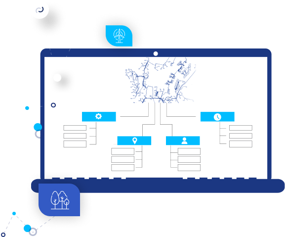
Leverage Industry Standards
Data Models & Geodatabases
Support the Exchange of Data
Data models help simplify the process of implementing projects and support the exchange of data between systems through adhering to industry standards, formalized naming conventions.
Align With Industry Standards
Many industries have defined “data models”, and GISonLine has the experience to convert or migrate your organization’s data into the formalized industry standards. Our data model expertise includes SDSFIE, Esri Utility Network, Esri Roads & Highways, and Esri Geometric Network associated with the support and management of utilities distribution.
Industry Specific Data Models
- Address
- Agriculture
- Atmospheric
- Biodiversity
- Building Interior Space
- Carbon Footprint
- Census
- Boundaries
- Defense – Intel
- Fire Service
- Forest Service
- Forestry
- Geology
- Groundwater
- Health
- Historic Preservation
- Homeland Security
- Hydro
- Land Parcels
- Local Government
- Marine
- National Cadastre
- Petroleum
- Pipeline
- Telecommunications
- Transportation
- Utilities
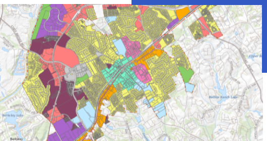
Quality of Spatial Data is Crucial to its Effective Use
Reduce the Impact of Bad Data
Having accurate and complete data is a critical component to ensuring that your business does not encounter the negative impacts associated with “bad data”.
As organizations continue to collect and inventory significant amounts of data for use within geospatial mapping systems, managing its quality becomes a core topic as the data supports key business operations and decision support.
Automate Your Data Quality Processes
GISonLine works closely with clients to shift the focus towards automation and ensuring data quality is built into business processes from the very beginning of data capture and data migration efforts.
Benefits of GISonLine’s Data Quality Services
- Automated software tools to validate and detect data errors
- Automated tools to check data integrity and completeness
- Built-in checks and alerts during data conversion and migration processes
- Validation of spatial accuracy to ensure GIS features & assets are location accurate

Get Access to Valuable Geospatial Data
Turn Your Analog Information Into Digital Data
One method of creating geospatial data is to digitize directly from existing analog (paper map) sources. This process capturing or digitizing information represented in the original analog data source and to translate it into digital formats that allow for easy access, analysis, and utilization within GIS systems.
Save Time & Improve Data Quality
The creation of high quality digital maps requires the right skillset, automation tools and experience in the field of geoinformatics. With expertise in data digitization and digital map creation, GISonLine’s team of engineers and geospatial data analysts have years of project experience that can save you time and improve the condition and quality of your data digitization project.
Mapping Products Designed To Fit Your Needs
GISonLine’s data capture and digitization services support clients in producing a wide range of mapping products and geospatial data to include:
- Utilities location maps
- Contour / elevation maps
- Spatial / cadastral maps
- Thematic and zoning maps
- Transportation & planning maps
- Landscape and environmental maps


Contact us
Looking for Location Intelligence?
