
Empowering the District Heating Efficiency by Implementing the ESRI Dashboard
Overview
Client: MPEC
Location: Krakow, Poland
In support of MPEC (Miejskie Przedsiębiorstwo Energetyki Cieplnej) business operations and the supply of district heating to Krakow residents, GISonLine provided geospatial mobile applications and custom web portals that provided geospatial resources and capabilities to MPEC’s asset management processes.
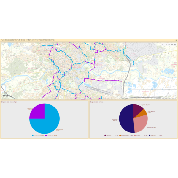
MPEC is one of the leaders in the heating industry in Poland providing heat to over 65 percent of residents in the city of Krakow. Heat from the MPEC utility network (almost 900 kilometers long) supports the heating of municipal entities.
The Challenge
In the world of infrastructure management, innovation is key. MPEC S.A. Kraków is at the forefront, systematically upgrading its network with cutting-edge technology to reduce heat loss and optimize energy usage. Adding to the challenge, Krakow’s rapid urban development demands an agile expansion of the heating network.
Seamless business operations rely on reliable network data accessible to everyone involved in network design, management, maintenance, and modernization.
The Impact
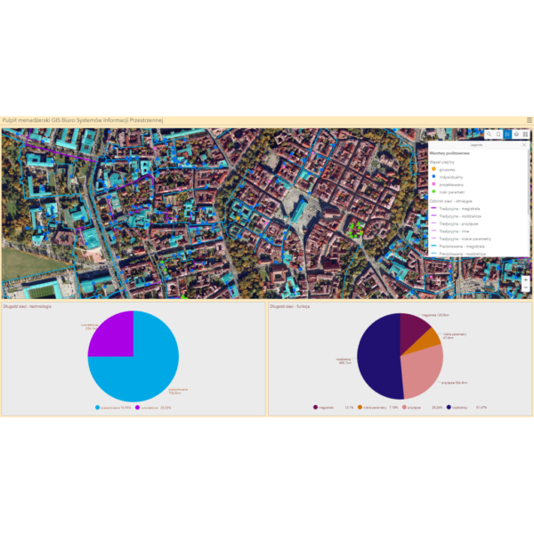
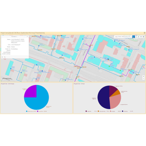
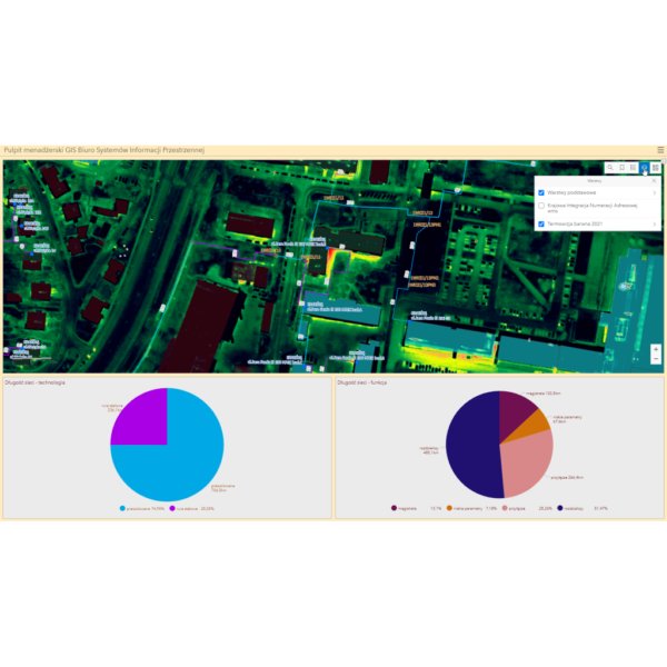
Up-to-date data in a modern web-Map dashboard. Access to information on the district heating network for a wide range of employees of the company, including the company’s management. Access to tools that allow the tracking of statistics on the development and modernization of infrastructure.
The Outcome
– Making data available to a wide range of recipients through dedicated GIS-web applications in technologies available within ArcGIS Enterprise.
– A dashboard for the company’s management in ArcGIS Dashboards technology presenting statistics on the company’s heating network, including the length of the network in terms of specific types, diameters or technologies used.


Client

Industry
Energy & Utilities
Region
Europe
Technology
ArcGIS Web AppBuilder
JavaScript, HTML, CSS
Esri ArcGIS Enterprise
Portal for ArcGIS
PostgreSQL


GRIDonLine is a comprehensive GIS Utilities Asset Management (AM) system designed to scale from small to large enterprise utility networks.


UTIL.Inspections is a cloud-based (SaaS) web mapping application designed specifically for viewing, integrating and collaborating on survey & inspection datasets.


The innovative UTIL.Investments platform is designed to address the needs of industries involved in the design and implementation of linear infrastructure projects.

Contact us
Looking for Location Intelligence?

