

Custom Solutions To Fit Your Needs
Custom Web & Mobile App Solutions
GISonLine provides custom web and mobile application development designed to help organizations grow their business and enable their operations & services with location intelligence solutions.
Rapid Prototyping & Client Interfacing
Our application development team works closely with clients to understand how custom applications support and enrich their business capabilities. The application development process includes rapid prototyping with Agile & Scrum techniques designed for client interaction and feedback to ensure product success.
ESRI or Open Source Technologies
- ESRI Solutions – developing or extended existing ESRI application components or applying advanced customizations to Esri products based on client requirements & needs.
- Open Source Solutions – custom application development using open source technologies such as Open layers, PostgreSQL / PostGIS, Geoserver.
- Hybrid Solutions – we create solutions that can combine the advantages of Esri and open source technologies to fit the needs of customer requirements such as licensing needs, user access, and security restrictions.
- API Solutions: we establish APIs that connect our custom solutions to existing business systems ensuring data flows and integration.
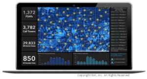
Dashboard Reporting

Custom Web Apps
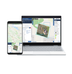
Mobile Apps

API Integration
Integrate Location Into Your Business Ecosystem
Agile Development
Our passion is building robust custom GIS solutions designed for any industry using Web and Mobile technologies. We use the Agile methodology to build, collaborate and support our custom solutions along with strong client interactions built into the process.
Client Involvement Approach
From GIS web portals, to mobile mapping applications, to automating workflows, GISonLine recognizes that custom built solutions require a strong understanding of client business needs and requirements. That’s why each development project has the fundamental concept of client involvement from the very beginning to the finished product.
Integrated With Your Business Ecosystem
Our development team excels at integrating custom applications and geospatial APIs with existing business systems so that access to data and performing spatial analysis exists wherever it is needed: in the office, in the field, at a customer’s site, and regardless of the devices used.
Cloud or On-Premise
Our cloud-based GIS solutions allow for scalable, secure and enterprise access for up-to-date and reliable information used by organizations and industries such as energy, utilities, public administration, environmental protection, defense and telecommunications.
We Speak Development Languages
Working with the latest Esri, Open-Source, and industry standard technologies, GISonLine is
developing highperformance and scalable spatial solutions for web and mobile projects.
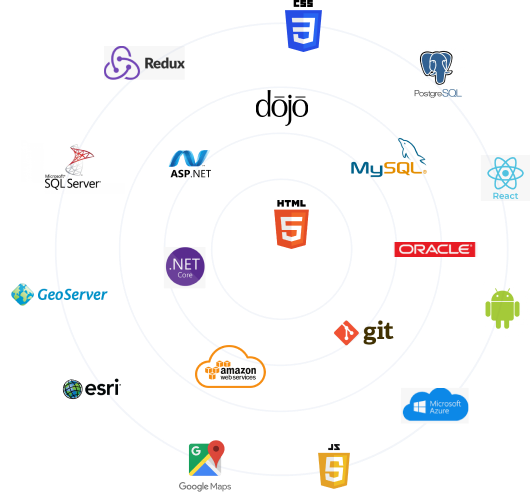
Frontend Development
JavaScript, jQuery,
Dojo, React +
Redux
jQuery, Vue,
HTML5, CSS3
Database
SQL Sever,
Oracle,
MySQL
PostgreSQL
PostGIS
Backend Development
C#
ASP.NET MVC
.NET Core
EntityFramework
WCF
WPF
Geospatial
ESRI
ArcGIS Server
ArcGIS APIs
GeoServer
OpenLayers
Google Maps
OpenStreetMaps
Build Your Own Team
Team as a Service (TaaS)
We offer Team as a Service (TaaS) resources, which are an efficient and scalable way for our customers to get access to experienced geospatial software developers, GIS architects, data managers and cloud services experts in support of their business needs.
Geospatial Experts At Your Service
GISonLine’s TaaS team members are a group of geospatial experts serving international customers with geospatial technology integration, spatial data management, and software development.
Our Team Is an Extension of Your Team
TaaS members assigned to a customer’s project are considered an extension to the customer’s staff and provide the expertise, staff augmentation, and support services to ensure success.

Benefits of Team as a Service
Transparent & Collaborative
TaaS software development is an efficient way for clients to add engineering, development, and quality control capacity to their team. GISonLine TaaS members interface directly with clients and stakeholders with regular online meetings.
Flexible & Agile to Business Needs
In a changing business landscape and requests for product changes / enhancements, clients have access to the GISonLine TaaS team to adapt development focus, implement new features, and / or scale development efforts to meet demand.
Scale Up Or Down
With TaaS software development, our clients know the rates of each TaaS team member and expenses are calculated based on the number of team members involved and their time spent on the project. Resources can be scaled up or down depending on a client’s business needs and priorities.
Product Support & Consultation
The TaaS team can provide multiple levels of product and service support serving either as a primary point of contact or tier 2 to 3 level of help desk support.


We Build Custom Energy & Utilities Apps
Location Technology Solutions
GISonLine has developed custom solutions using Esri and Open Source technologies in support of the growing needs of the energy & utilities industry.
Visualizing and analyzing the complex spatial relationships that exist between critical infrastructure, environmental resources, urban and community development are examples of important components that play a significant role in decision support for energy and utilities asset management.
That’s why GISonLine created the GRIDonLine, INSPECTonLine and ARonLine product suite, which are designed specifically for the Energy & Utilities industry to provide organizations with enterprise tools for asset management, utility inspections, and augmented reality visualization of underground infrastructure.
GISonLine
location products


GRIDonLine is a comprehensive GIS Utilities Asset Management (AM) system designed to scale from small to large enterprise utility networks.


UTIL.Inspections is a cloud-based (SaaS) web mapping application designed specifically for viewing, integrating and collaborating on survey & inspection datasets.


The innovative UTIL.Investments platform is designed to address the needs of industries involved in the design and implementation of linear infrastructure projects.

Contact us
Looking for Location Intelligence?
