
Supporting Environmental Management at Former Military Bases With Underground Detection (Grodków, Poland)
Overview
Client: CENTROZŁOM WROCŁAW S.A.
Location: Grodków, Poland
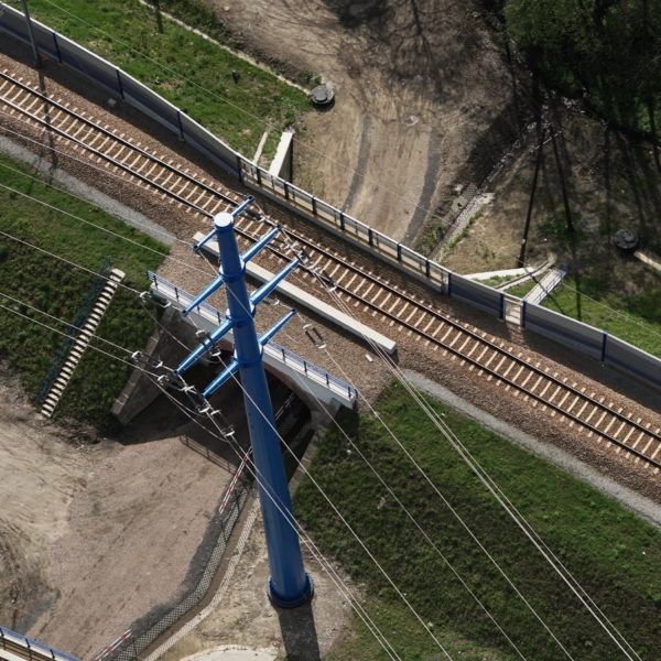
Roughly 60 kilometers (37 miles) south from the city of Wrocław is the town of Grodków in the Opole region of Poland. Grodków is steep in history and is the location of a former WWII German air base. Today, there is not much left of the base. Only small traces of above ground indicators hint at the location where hangars once stood and concrete slabs reveal the past existence of buildings.
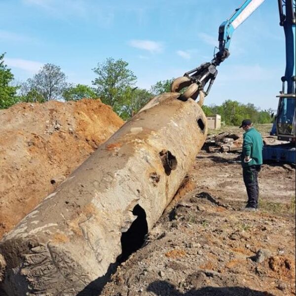
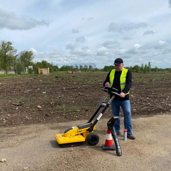
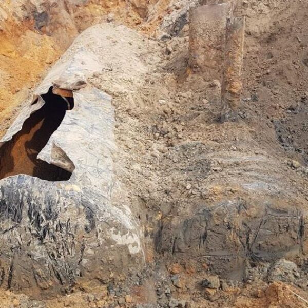
In support of environmental management and cleanup efforts, GISonLine was pleased to take part in providing underground detection services to identify the location of buried objects, storage tanks, and old munitions at the Grodków site.
The Impact
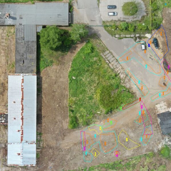
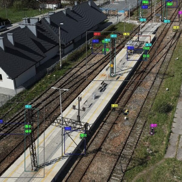
GISonline performed aerial drone surveys to collect high-resolution color imagery that enabled the production of detailed orthophoto maps. The orthophoto maps provided visualization of current site conditions along with the spatial mapping of above ground objects and remaining infrastructure. Ground Penetrating Radar (GPR) surveys were also conducted to identify objects and assets that were buried beneath the ground such as old storage tanks and munitions.
The Outcome
GISonLine successfully completed the Grodków site surveys and produced key deliverables such as 2D and 3D mapping products. The up-to-date mapping products and underground detection surveys were used to identify the precise location and depths of buried objects. Together with the high-resolution aerial imagery, a complete site picture depicting above and below ground assets was made possible in support of planning and environmental management efforts.


Client

Industry
Environmental Management
Survey & Inspection
Region
Europe
Technology
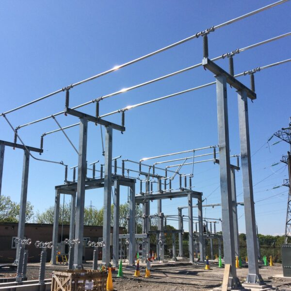
GPR - Lecia DS2000
Aerial Drones


GRIDonLine is a comprehensive GIS Utilities Asset Management (AM) system designed to scale from small to large enterprise utility networks.


UTIL.Inspections is a cloud-based (SaaS) web mapping application designed specifically for viewing, integrating and collaborating on survey & inspection datasets.


The innovative UTIL.Investments platform is designed to address the needs of industries involved in the design and implementation of linear infrastructure projects.

Contact us
Looking for Location Intelligence?

