

Value-Added Esri Solutions
GISonLine is proud to be an Esri Business Partner and specializes in providing services, products, and custom solutions based on the Esri ArcGIS Platform. Our experienced team of Esri developers and professional consultants provide technical and customized ArcGIS solutions tailored to fit your organization’s specific business needs.
Enterprise GIS &
Data Management
Web & Mobile
Mapping
Custom
Solutions
ArcGIS Utility Network
Enterprise-wide management of utility networks
Next Generation Utility Network Management
ArcGIS Utility Network is the next generation spatial information system for managing utility networks. GISonline, along with its partner network, offer a full range of ArcGIS Utility Network consulting and implementation services.
Utility providers are continually experiencing business change & transformation to meet the demands from customer and industry shifts towards modern platforms and grid distribution.
GISonLine provides support and expertise to help organizations wishing to prepare for and migrate to the latest ArcGIS Utility Network platform.

Copyright Esri Inc. All Rights Reserved
Advanced Utility Network Modeling
With its advanced network modeling and analytical capabilities, the ArcGIS Utility Network software enables an organization to manage its ecosystem of utility assets with finer details and insights supporting communications & users across the enterprise.
Smart Grid and IoT Integration
As a next generation utility & asset management platform, ArcGIS Utility Network integrates with smart grid technology, distributed generation, Internet of Things (IoT), and provides operational insights that support real-time decision making.
Start with a well-planned transition
Collaboration with GISonLine’s ArcGIS Utility Network team, provides access to experienced professionals who can help you formulate a comprehensive transition strategy and roadmap. Each transition strategy takes into account your existing systems, data sources and business processes to help you formulate a successful transition to ArcGIS Utility Network.

Copyright Esri Inc. All Rights Reserved

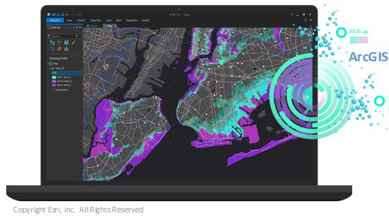
ArcGIS Enterprise
Share maps and data from any device,
anytime and anywhere using Esri’s ArcGIS platform.
ArcGIS Enterprise is the core software system for web-based geospatial mapping and provides enterprise wide data visualizations, analytics, and feature rich data management capabilities.
GISonLine developers and system integrators have extensive experience in supporting customers with their ArcGIS Enterprise implementations, configurations and customizations to include:
- Deployment of ArcGIS into local infrastructure and / or the cloud
- Development of custom applications and Cloud Portals
- Advanced spatial analytics and custom tools
- Enterprise data integration, migrations and spatial data management
- Establishing enterprise sharing and user collaboration
- Data publishing for use in maps and portals

Copyright Esri Inc. All Rights Reserved
ArcGIS Online
Software-as-a-Service (SaaS) mapping platform
connecting people, locations, and data
ArcGIS Online runs on Esri managed and hosted cloud infrastructure and is offered as a SaaS subscription model. With Esri taking care of the ArcGIS Online hosting, maintenance and software updates, your organization can focus on its business operations and using the ArcGIS Online platform to create, share and communicate your enterprise data and maps.
Let GISonLine support your organization with the implementation and customization of ArcGIS Online applications and integration services. With an experienced team ready to empower your enterprise, GISonline provides a variety of ArcGIS Online services to include:
- Delivery and implementation of ArcGIS Online for your organization
- Customization of ArcGIS portals and embedding maps for use on websites
- Integration of ArcGIS Online with other enterprise or business systems
- Integration of ArcGIS Online with mobile, desktop and field collections
Visit GISonLine’s Client Case Studies to see how ArcGIS Online was implemented and customized to supported Energy & Utility distributors.

Copyright Esri Inc. All Rights Reserved
The artwork comes from the Esri Inc. websites. The products, services and companies referenced may be trademarks, service marks, or registered trademarks of their respective owners.
Custom Esri Solutions
GRIDonLine Utilities Asset Management
The GRIDonLine GIS application is built upon Esri’s ArcGIS platform and offers a cost effective and feature rich set of capabilities designed specifically for Utilities Asset Management.
Remove Asset Management Barriers
GISonLine understands that barriers like costs, infrastructure, and enterprise licensing can pose as challenges to organizations wishing to implement a modern GIS enterprise asset management platform. To address these challenges, GISonLine created GRIDonLine to support today’s utility operators and distributors with the inventory and management of their enterprise utility assets such as: water, gas, electric, wastewater, and telecom.
Integrate With Other Asset Management Systems
GRIDonLine offers a suite of components supporting the integration of ArcGIS Enterprise and ArcGIS Server with SAP and Maximo solutions.
Take Advantage of Topology Network Analysis
GRIDonLine offers Graph-based topology network solution that serve as an alternative when ArcGIS Utility Network is determined to be too expensive or too complex.


Contact us
Looking for Location Intelligence?
