

ARonline
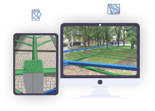
Real Time 3D Visualization of Underground Utilities
Augmented Reality Visualization
ARonLine is an Augmented Reality (AR) application specifically designed for visualizing underground utilities and assets. ARonLine uses AR technology to superimpose digital information (like geospatial utilities data) onto a mobile device’s camera view.
Increase Field Crew Safety
Utility crews, excavators, engineers and construction teams use the ARonLine mobile application to visualize the location of underground utilities in real time. Increase field crew safety and reduce the risk of damages to underground assets.
Simple and Easy to Use Interfaces
The ARonLine application User Interfaces are simple and easy to use and provide field crews and constructions teams with the ability to quickly visualize underground utilities and assets.


Visualize Your Underground Assets
With Augmented Reality
Changing How We Visualize Data
Augmented Reality (AR) technology is quickly changing the way we interact and visualize the physical world. There are multiple use-cases where visualizing what is buried beneath the surface of the ground plays an important role in areas such as public safety, utilities management and construction projects.
Underground Surveys & Detection
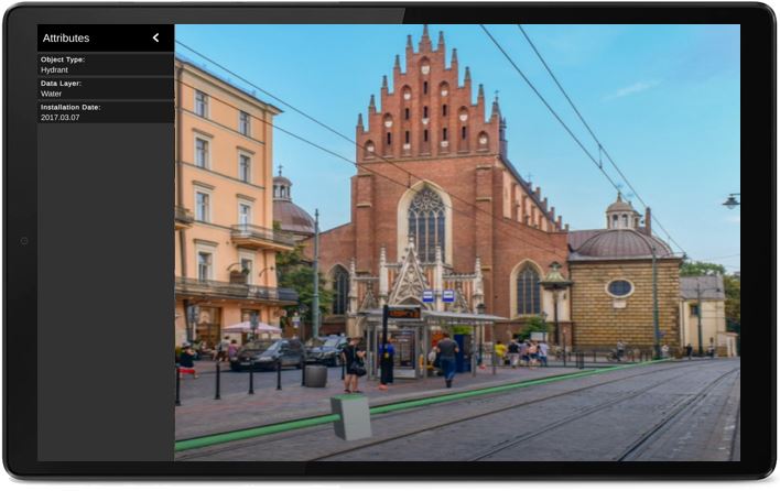
GISonLine specializes in underground infrastructure detection and surveying using specialized equipment such as Ground Penetrating Radar (GPR) and Electro-Magnetic Locators (EML) to create a digital and accurate representation of what is buried underground.
Utilities Mapping and AR Visualizations
Combine the results of a precise underground survey and detailed mapping of sub-surface utilities with 3D visualization using ARonLine.
- Comprehensive understanding of sub-surface infrastructure
- Real time 3D visualization of the location, depth and characteristics of utilities
- Improve key decision making, worker efficiency, and site safety
- Utilize Esri GIS or CAD data within the ARonLine application
Use Your Existing Underground Utility Data
Using Your Existing GIS and CAD Utilities Data
Take advantage of your existing utility datasets (water, gas, electric, telecom..etc) managed and maintained within your GIS or CAD systems and use ARonLine to easily and accurately visualize what lies beneath the surface.
- Locate and visualize underground infrastructure in real time
- Identify gaps in data during site visits
- Avoid accidental utility line cuts at project sites
- Communicate with project teams to share and visualize utility data
Energy & Utilties Solutions
Get access to a suite of geospatial tools and applications designed specifically for viewing and managing utility assets

GRIDonline
GRIDonLine is a utility network management and analytics GIS platform designed for Utilities Asset Management & operations support for: water, gas, electric, wastewater, telecom and more...
UTIL.Inspections
A cloud-based (SaaS) web mapping application designed specifically for viewing, integrating and collaborating on survey & inspection datasets
UTIL.Investments
The innovative UTIL.Investments platform is designed to address the needs of industries involved in the design and implementation of linear infrastructure projects.

Contact us
Looking for Location Intelligence?
