AI and ML-based service for traction network inventory and monitoring
Purpose / Application
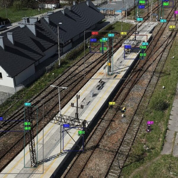
The AI (Artificial Intelligence) and ML (Machine Learning) -based traction network inventory and monitoring service is a comprehensive solution offered by GISonLine. The service includes conducting aerial surveys and processing data collected using unmanned aerial vehicles (UAV). It takes advantage of all the benefits of professional UAV systems without unnecessary risks and costs.
Artificial intelligence and machine learning methods enable the automation of processes for identifying and locating traction network components. This results in:
- Reduced time for inspection/analysis
- The ability to perform inspections/analyses remotely
- Increased safety by reducing the number of “manual” inspections in trackside areas
- Fewer failures thanks to early detection of damages
The method can also be used, for example, to estimate damage caused by transportation accidents in real time or to assess the quality of completed service works and renovations.
Innovative approach
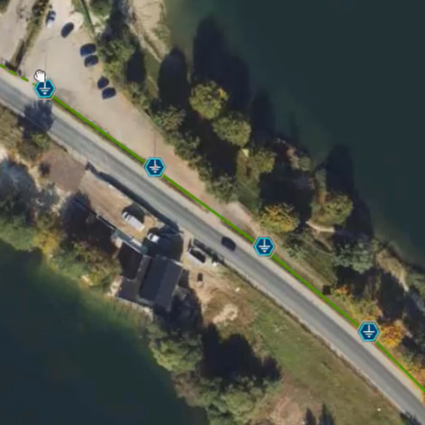
During the pilot implementation an innovative approach to data preprocessing was developed in collaboration with researchers from Wrocław University of Science and Technology. In particular, heatmaps were used to identify spatial sequences with higher likelihood of encountering the desired traction elements. Group analysis based on object hierarchy was performed to detect small but important components of the traction network. This involved searching for small network elements (e.g. hangers or insulators) in a specific spatial relationship to larger, easier-to-identify objects (e.g. support structures). At GISonLine, we added to that an algorithm for automatically assigning geographic coordinates to the identified objects.
Performance of the method
The effectiveness of the AI-based traction network inventory and monitoring service depends on the quality of the data used during model training as well as the data collected from the aerial survey.
During test implementation, a high accuracy in object recognition was achieved. The total inference time was approximately 900 ms per image.
Further directions of the implementation and development of the method
The method applied can be enhanced and developed through the use of laser scanning data (Lidar) or by increasing the pool of objects used for training. Ultimately, full automation of the process is achievable.
In terms of thematic development, the method could also expand to address issues such as:
- Location of wooden sleepers awaiting replacement with concrete ones
- Assessment of railway ballast quality to determine the need for replacement
- Assessment of the degree of wear of electric traction cables
- Information on the precise routing of electric cables
Comprehensive service
GISonLine possesses its equipment, software, and copyrights for the developed method. Through the pilot project, our team has acquired the necessary skills in applying machine learning tools. Combined with our previous experience in network industry implementations, this prepares us to handle the entire process of service delivery.
Need a fresh but reliable solution for supporting management of your network assets? Feel free to contact us!
Client
Industry
Energy & Utilities
Survey & Inspection
Consumer Applications
Region
Worldwide
Technology
Artificial Intelligence
See some things
we've worked on
GRIDonLine is a comprehensive GIS Utilities Asset Management (AM) system designed to scale from small to large enterprise utility networks.
UTIL.Inspections is a cloud-based (SaaS) web mapping application designed specifically for viewing, integrating and collaborating on survey & inspection datasets.
The innovative UTIL.Investments platform is designed to address the needs of industries involved in the design and implementation of linear infrastructure projects.

Contact us
Looking for Location Intelligence?


