INSPECTonLine Product Now Available 2018
December 2018
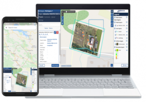
Manage the Inspection Process
GISonLine is pleased to offer the INSPECTonLine product as part of its location technology suite. INSPECTonLine is a cloud-based geospatial platform designed to manage inspection and drone (UAV) operations and streamline quality control processes.
INSPECTonLine addresses the need to conduct quick and accurate inspections with the goal of reducing maintenance costs, improving decision support, and providing integrated data visualizations via: live drone video feeds, photos, 3D models, ESRI and CAD data.