
Transforming the water and wastewater network management through the implementation of the Utility Network
Client: Water Supply Company
Location:, Poland
The Water distributor is the majority shareholder of the Water and Sewage Authority in Silesia, a company operating for the benefit of 80,000 inhabitants.
Total length of networks in operation:
- water supply network: 683 km
- sewage network: 393.8 km
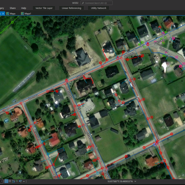
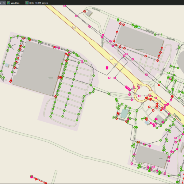
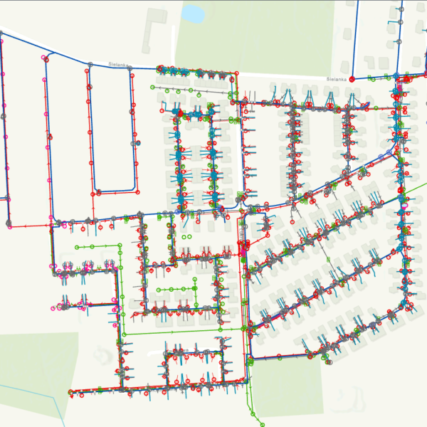
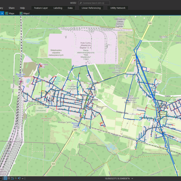
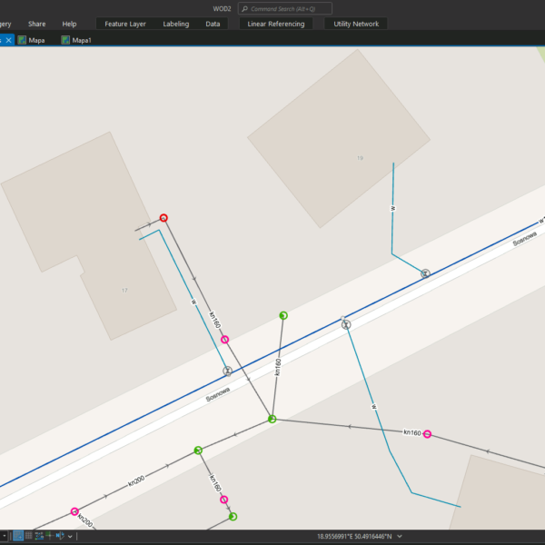
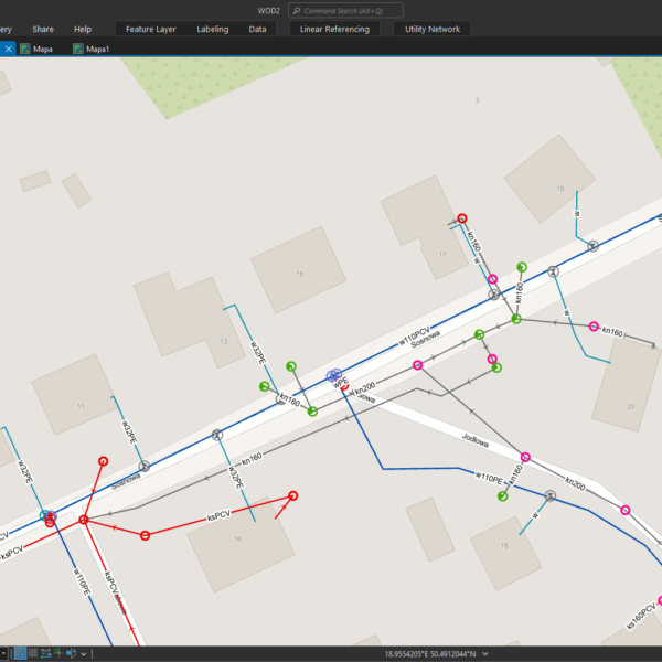
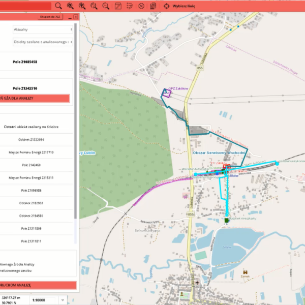
GISonLine implemented ESRI Utility Network technology to optimize network management processes by creating a faithful model of the water and wastewater network
The Impact
The customer provides high-quality services in the field of collective water supply, sewage collection and treatment and sewage sludge management to local governments and industry.
Implementing the Utility Network model designed for managing water and wastewater network
Implementation of Utility Network technology enabled optimization of network management processes through faster access to information about failures and events thanks to the analytics module in ESRI’s solution.
Another benefit is the ability to inform users of water supply interruptions in advance.
The Outcome
GISonLine successfully implemented the ESRI Utility Network solution platform into customer’s business operations. Now the customers’ users can effectively utilize the mechanisms of the guided editing, quality validation and network rules, supporting customer’s employees with their network management business processes.


Client
Industry
Energy & Utilities
Region
Europe
Technology
ArcGIS Experience Builder
JavaScript, HTML, CSS
Esri ArcGIS Enterprise
Portal for ArcGIS
PostgreSQL
See some things
we've worked on


GRIDonLine is a comprehensive GIS Utilities Asset Management (AM) system designed to scale from small to large enterprise utility networks.


UTIL.Inspections is a cloud-based (SaaS) web mapping application designed specifically for viewing, integrating and collaborating on survey & inspection datasets.


The innovative UTIL.Investments platform is designed to address the needs of industries involved in the design and implementation of linear infrastructure projects.

Contact us
Looking for Location Intelligence?

