
Identifying & Mapping “Safe Locations” for Borehole Drilling on Nile Street (London, UK)
Overview
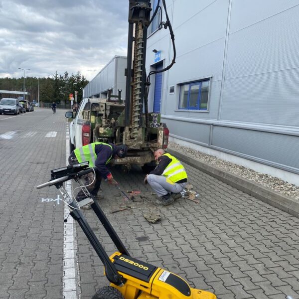
Nile Street in Hackney is a high-density development area located approximately 2 miles north from the center of London. As an urbanized area, any excavation or ground digging would be highly dangerous without prior identification of underground utilities.
In support of the new development and investment planning on Nile Street, it was necessary to conduct borehole drillings to determine the ground structure and soil compositions. GISonLine was pleased to support the Greater London Authority (GLA) with underground detection and survey services that supported the safety of the drilling crews and identification of safe locations for the drilling of the boreholes.
The Impact
GISonLine performed the underground detection surveys using ground penetrating radar (GPR) and advanced detectors to establish surface markings that delineated “safe locations” where the drilling of the boreholes could be conducted.
The Outcome
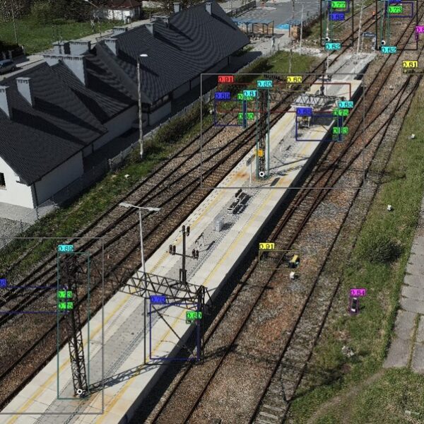
GISonLine successfully completed the underground detection survey and provided the data in 2D and 3D formats for a clear understanding on the exact location of underground utilities. Using the 2D maps and 3D models depicting the underground utilities and sub-surface objects, the planning of where to conduct the borehole drilling and inspections was selected and identified prior to any drilling operations.
The project represented the high requirements to provide accurate location identification of sub-surface utilities for the prevention of damages to underground infrastructure and ensuring worker safety.


Client

Industry
Survey & Inspection
Region
Europe
Technology
Ground Penetrating Radar Lecia DS2000
Detector - Leica Ultra Advanced
GNSS solution - Leica CS20/GS16
CAD and GPR software


GRIDonLine is a comprehensive GIS Utilities Asset Management (AM) system designed to scale from small to large enterprise utility networks.


UTIL.Inspections is a cloud-based (SaaS) web mapping application designed specifically for viewing, integrating and collaborating on survey & inspection datasets.


The innovative UTIL.Investments platform is designed to address the needs of industries involved in the design and implementation of linear infrastructure projects.

Contact us
Looking for Location Intelligence?

