
Increasing Safety and Visualization of Underground Utilities Using Augmented Reality Technology
Overview
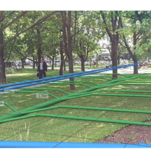
As part of GISonLine’s support to the Energy and Utilities industry, the ARonLine mobile application was developed using Augmented Reality (AR) Technology. ARonLine was designed to improve the safety of field crews and construction site workers by providing the ability to visualize underground utility data using AR visualizations made available on mobile devices.
The Impact
Field crews and mobile workers have the ability to visualize the location & attributes of underground utilities using the ARonLine application. The application provides user friendly interfaces for mobile users in the field and the ability to organize their utilities data based on project sites.
The Outcome
GISonLine successfully designed and implemented the ARonLine product allowing mobile teams the ability to transform their CAD and GIS utilities data into 3D Augmented Reality (AR) visualizations. The ARonLine application is designed to visualize underground utilities such as:
• Electrical
• Water
• Gas
• Telecommunication
• Sewage / drain
• Steam


Client
Industry
Energy & Utilities
Infrastructure
Transportation
Local Government
Survey & Inspection
Region
Worldwide
Technology
Android
JSON
Unity


GRIDonLine is a comprehensive GIS Utilities Asset Management (AM) system designed to scale from small to large enterprise utility networks.


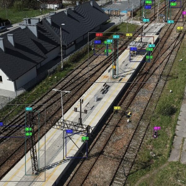
UTIL.Inspections is a cloud-based (SaaS) web mapping application designed specifically for viewing, integrating and collaborating on survey & inspection datasets.


The innovative UTIL.Investments platform is designed to address the needs of industries involved in the design and implementation of linear infrastructure projects.

Contact us
Looking for Location Intelligence?

