Aerial Inspection

Using aerial drones for the inspection, inventory, and maintenance of utility assets & infrastructure

Aerial Drone Inspections

Drones offer safe and efficient operations to significantly reduce inspection times, save on labor costs, and increase the safety of field crews and inspectors.  Aerial inspections using drones are ideal for inventorying and assessing the condition and state of:

  • Power Lines / Cell Towers
  • Wind turbines
  • Solar Panels
  • Road/Rail Transportation Networks
  • Distribution Lines
  • Construction Projects

Advanced Sensors & Data Collections

Aerial drones are equipped with multiple sensors designed to capture high quality data and provide valuable information in support of asset visualization, inventory, maintenance, planning, and issue resolution.

  • High Resolution Color imagery
  • High Resolution Video
  • LiDAR
  • Thermal Imaging
  • Multispectral


Identify Utility Faults & Issues

Drones are ideal for identifying utility asset faults and detecting fine damages and issues from afar reducing the risks to personnel and their equipment. The detailed and accurate data delivered by a drone inspection enables inspectors and utility assset managers to proactively identify defects and plan for issue resolutions.

Contact us Case Studies

Aerial Inspection Benefits

Improve inspection efficiency, increase worker
safety, and lower the risks of asset failures

Reduce Risks

Reduce the risks to field crews by using drones to inspect hard-to-reach areas

High Quality Data

Utilize multiple sensors, high-resolution imagery, and video capture to collect high quality data about your assets

Workflow Efficiency

Drone inspections are an effective way to reduce manual inspection processes and improve efficiency

Resolve Issues

Identify, document and plan issue resolution using drone data and automated fault detection

Flight Safety

GISonLine offers certified and experienced drone operators to support aerial inspections & flight operations

Integrate & Collaborate

Utilize the INSPECTonLine web and mobile platform to integrate and view inspection datasets and collaborate with your team

Aerial Inspection Sectors

Using drones to visualize, inspect, and manage utility and infrastructure assets

Aerial Drone Survey

Power Line Inspection

Wind Turbine Inspection

Solar Panel Inspection

Transportation Inspection

Distribution Line Inspections

Construction & Infrastructure

Our Drone Platforms

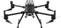
MATRICE 300 RTK

A Lidar + RGB Solution for Aerial Surveying
  • A Lidar + RGB Solution that gives you real-time 3D data collections
  • Generate true-color point cloud models in real-time, or acquire 2 km2 of point cloud data in a single flight
  • Efficiently captures the details of complex structures and delivers highly accurate reconstructed models.
  • Renders centimeter-accurate reconstructions thanks to the high-accuracy IMU, a vision sensor for positioning accuracy, and the incorporation of GNSS data.
  • Enables transmission up to 15 km away with reliable flight near high-interference environments

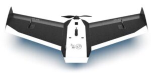
UAV BIRDIE

Survey-Grade Accuracy
  • Designed for survey-grade accuracy and high-quality data.
  • Flight time up to 60 minutes
  • Preparing topographic and cadastral maps
  • Preparing digital elevation models (DEMs)
  • Efficient mapping coverage up to 8 sq km in one flight
  • 24-Mpix camera for high quality image capture
  • Optional 42-Mpix full-frame optical sensor

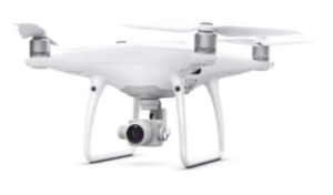
DJI Phantom 4PRO

Able to record UHD 4K at a bitrate of 100Mbps
  • 20 Mpix camera for high-quality data
  • Especially suited for high congested areas
  • Provides LIVE-broadcasting
  • Well suited for detailed infrastructure inspections

Post Processing & Data Deliverables

GISonLine specializes in offering services to process and prepare data
collected from drone aerial surveys to meet your inspection and business needs.

Orthophotos


Digital Terrain Models

Integrate high-resolution orthophoto imagery collected during drone surveys to produce digital orthophotos and mosaics. An orthophoto is an aerial photograph that has been geometrically corrected so that the scale of the photograph is uniform and can be used to measure distances.

Take advantage of LiDAR sensors to produce a 3D model of your project or inspection site. LiDAR is a method used for creating point clouds, digital terrain Models (DTM), and digital elevation models (DEMs).

Georeferenced Photos


High-Resolution Video

Capture high resolution photos and georeference them to their location and coordinate system. Integrate the data and photos with your geospatial mapping tool to visualize each point on the map tied to an asset image.

Cameras on today's drones can capture high resolution video producing large amounts of data. GISonLine has the experience to edit and process the drone video feeds and integrate the data into your business operations and products.

INSPECTonLine

A cloud-based mapping solution designed specifically
to visualize, collaborate, and manage your inspection data.

Your Inspection Data All in One Spot

INSPECTonLine is a web-based geospatial platform enabling an organization to store and visualize their inspection data and collaborate using an easy-to-use web solution

Integrate Drone Data Collections

Integrate your drone data with your existing Esri GIS, CAD, and 3D models and take advantage of INSPECTonLine’s base maps to add detailed geospatial information and reference data to your inspection project.

INSPECTonLine

Contact us

Looking for Location Intelligence?