INTERGEO International Surveying Fair Frankfurt 2018
19 October 2019
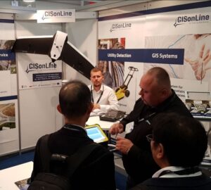
Booth Crowds & GPR
The GISonLine booth drew a lot of attention as our director of underground surveying explains the use of ground penetrating radar (GPR) using the latest equipment and methods of detection.
Underground infrastructure detection is a surveying process that uses specialized equipment such as GPR and Electro-Magnetic Locators (EML) to create a digital representation of what is buried underground.
GISonline also presented methods of creating 3D models of underground utilities, which provides an accurate model and detailed visualization of underground utility assets. 3D geometric models of underground utilities changes the way you visualize and interpret data and allows end-users see all aspects of a project site.