
Improving Construction Site Visualization Using 3D Models of Above & Below Ground Infrastructure
Overview:
Client: Exact
Location: Bad Bevensen, Germany
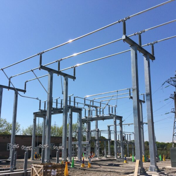
The objectives of this project were to create a comprehensive digital visualization using 3D models of the aboveground and belowground infrastructure covering an area of planned construction of an industrial facility in Bad Bevensen, Germany.
The Impact:
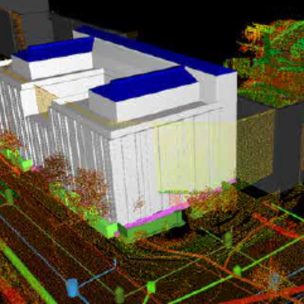
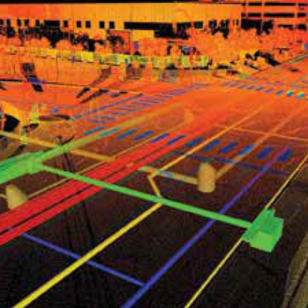
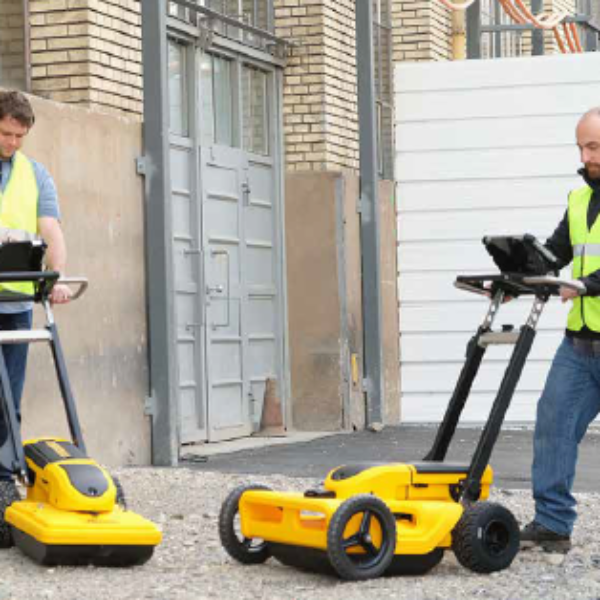
The GISonLine Underground Detection Team acquired Ground Penetrating Radar (GPR) measurements and inspection data for the underground infrastructure survey covering an area of more than 12,000 m². In addition, point-cloud data from the terrestrial laser scanner and imagery from the Unmanned Aerial Vehicle (UAV) were used to collect high-resolution data for the above ground structures.
The Outcome:
Together with our survey partner (EXACT), GISonLine successfully surveyed the project site using GPR underground detection methods. The underground detection data was used to establish a detailed 3D model of the underground assets.
The sub-surface data was then combined with the aboveground datasets collected from the laser scanning and UAV imagery to form a comprehensive 3D model and representation of the construction site.
Deliverables associated with this project included:
- Inventory of underground infrastructure (GPR measurements)
- Creation of digital maps of the above and below ground infrastructure
- Development of 3D models
- Delivery of the data obtained from the GPR, UAV, and laser scanning


Client
Industry
Energy & Utilities
Survey & Inspection
Region
Europe
Technology
3D Modeling
UAV
Laser Scanning
GPR Surveys
Revit
AutoCAD


GRIDonLine is a comprehensive GIS Utilities Asset Management (AM) system designed to scale from small to large enterprise utility networks.


UTIL.Inspections is a cloud-based (SaaS) web mapping application designed specifically for viewing, integrating and collaborating on survey & inspection datasets.


The innovative UTIL.Investments platform is designed to address the needs of industries involved in the design and implementation of linear infrastructure projects.

Contact us
Looking for Location Intelligence?

